Only a limited number of passageways exists to cross some of the highest and most brutal mountains in all of Europe. The Greater Caucasus has for centuries been an almost insurmountable obstacle for armies, merchants, and travelers of all kinds. With peaks that reach more than 5,000 meters (16,404 feet), it’s no surprise that it would take a monumental project to make it passable.
The Georgian Military Highway is one of the few safe, mass-transit passageways through these prohibitive heights. Now a paved and well-kept roadway, it has not always been this way, requiring constant updating throughout history. This history goes back centuries into Georgia’s earliest civilizations, being an influential part of the entire region.
The route has been a passageway for travelers since ancient times. While not as developed as it is now, it has been road for merchants since the early Georgian kingdoms. Greek cartographer Strabo talks of this in his Geographica, and Roman Pliny the Elder describes the mountain pass in his writings, lending to the history this road has in the region.

Throughout the Middle Ages, it served as a trade route as well as an invasion route for Chechen and Dagestani tribes into Khevsureti. Mongol hordes in the 13th century used this route to claim much of the land, bringing the kingdom of Georgia into the fold of Mongolian generals Subutai and Jebe.
However, it wasn’t until the late 18th century that it would begin to see its construction into a modern thoroughfare. Gottlob Heinrich Curt von Tottleben, a German-born Russian general, was one of the first to pioneer into the mountain pass, with his army, crossing through the Darial Pass to help fight off an Ottoman force in the south of Georgia.
Following the Treaty of Georgievsk, the road became the primary route into the new protectorate of the Russian Empire. As this treaty removed any dependence on Persia from the Georgian Kingdom of Kartli-Kakheti, the road was firmly established as an economic thoroughfare.
It became more modernized under the brutal rule of Russian General Aleksey Petrovich Yermolov. When asked why it was so necessary to be harsh on the Caucasian peoples, he replied to the Tsar, “I desire that the terror of my name shall guard our frontiers more potently than chains or fortresses.” Despite this, he was instrumental in ensuring a good surface and width for the road for the mass transportation of troops, supplies, and the increase of commercial traffic.
The road grew from the immense military importance of the Russian wars against Persian, enemy Caucasian, and Circassian tribes during the Caucasian War (1817-1864), the Russo-Circassian War (1763-1864), and the Murid War (1817–1864). Into the 20th century, the road played a principal role in the social, economic and cultural development of Georgia and the rest of the South Caucasus.

In the 20th century, with the advent of automobiles, the road became a paved highway capable of transporting thousands of tons of goods. However, the new construction brought new hazards.
Continuous drilling and advanced modernization threatened the stability of the rock faces that the road was hewn from. Landslides and rockfalls are even today a common problem for the government authorities tasked with upkeep of the road.
As a military road, it has largely diminished in importance due to modern equipment, technology, and tactics. Tracked and heavily armored vehicles are not able to traverse the road safely, being vulnerable to ambush and roadblocks, and today, the majority of issues stem from large transport carriers navigating the narrow mountain road.
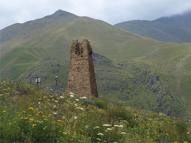
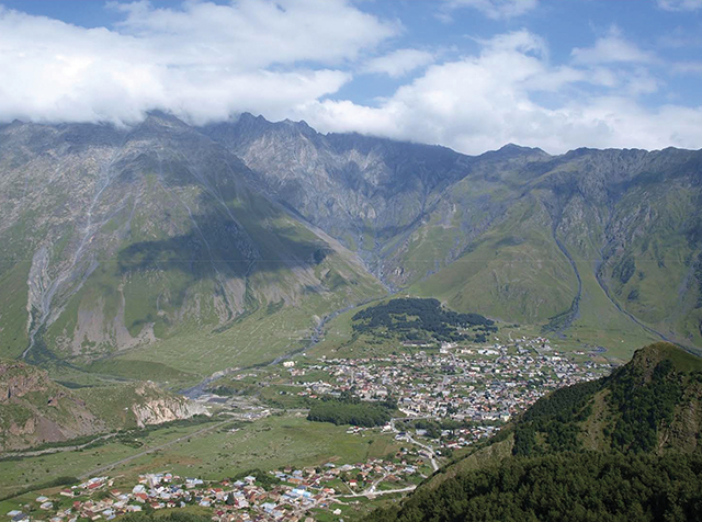
While it is primarily a trade route for Georgia and Armenia to Russia, it is still an impressive region of the country. Along with several locations along its length, the road itself offers tourists impressive views of the vast Greater Caucasus Mountains. Its jagged peaks, remote monasteries, and largely untouched beauty give visitors a look into the eyes of an ancient Georgian merchant.
Heading north of Tbilisi, past the ancient fortress of Ananuri, it is an easy road to the Russian border. Popular places such as Pasanauri, Gudauri, Stepantsminda, Gergeti Trinity Church, and finally the Dariali monastery complex near the Lars border checkpoint, are close by the route. While its historic importance may have passed, its value as a travel destination, ranging 212 kilometers (132 miles) between Tbilisi and Vladikavkaz, continues.
By Michael Godwin


