Georgia has established a unified database of land resources for the first time in two decades, the Ministry of Environmental Protection and Agriculture announced, marking a significant step toward improving land management and data transparency.
The database was developed in cooperation with the National Agency for Sustainable Land Management and Land Use Monitoring and brings together comprehensive, systematized information on the country’s land fund.
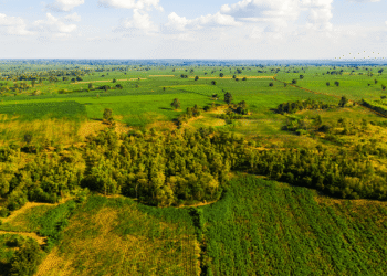
Ministry says the platform categorizes land resources into two main groups: agricultural and non-agricultural lands. Agricultural areas are further divided into land used for annual and perennial crops, while non-agricultural lands include forests, protected areas, glaciers, lakes, and urban territories.
Giorgi Misheladze, Chairman of the National Agency for Sustainable Land Management and Land Use Monitoring, said the absence of a unified system in previous years forced authorities to rely on fragmented sources, including public registry data and statistics often based on oral reporting.
“This data was scattered and fragmented. Today, the unified database combines information processed by the ministry, the public registry, and other agencies, along with verified data from our agency, which will facilitate the work of both the government and the public sector,” Misheladze noted.
The new database is publicly accessible and is expected to support more effective policymaking, land-use planning, and environmental management. It also aims to improve transparency and provide reliable data for researchers, businesses, and citizens.
The database is public and available at https://land.gov.ge/Ge/Services/Database while the interactive map is acessible at the Ministry’s geographic information portal – https://portal.mepa.gov.ge/Ge/user/map/34
Image: 1TV