Invasive plant species (IPS) are species that are not native to an ecosystem which invade and take over another territory, mostly as a result of human activity- being either deliberately or accidentally introduced. Some of these might harm the ecosystem, while other introduced species may have little or no negative impact. IPS can grow and spread rapidly and widely, competing with the native species and sometimes replacing them in the ecosystem. This in turn can impact the overall economy and many components of the ecosystem.
The general characteristics of most invasive plant species are rapid dispersal, rapid growth and reproduction. They also have a high tolerance level, making them more competitive than the local species, often replacing them in the ecosystem and leading to a decrease in plant species diversity. Some IPS also affect other components of the natural environment, such as water quality, or can lead to soil erosion, resulting in the decline of the ecosystem sustainability.
Several such invasive plant species have been identified in Kolkheti National Park: “Invasive species are a big problem in Kolkheti National Park. Gleditsia triacanthos (L), Amorpha fruticosa (L), Sparganium emersum (Rehmann), Solidago virga aurea L., and Solidago canadensis L. have already caused a lot of damage to local ecosystems,”Vasil Metreveli, Forester, Ilia University, says. “Amorpha fruticosa actively occupies the banks of rivers and canals and has practically replaced the local flora.
“The invasion is actively promoted by human activity in this area,” he notes. “For example, as we know, grazing is a big problem for forests in general. In the case of Kolkheti, grazing causes a big problem for the saplings and seedlings. However, not in the case of Gleditsia triacanthos (L), because it is a thorny plant. Accordingly, representatives of the local flora are grazed, and this promotes the invasion of Gleditsia.
“Mowing is also a big problem. Locals mow areas where there are mossy (Sphagnum palustre L. and Sphagnum papilosum Lindb.) swamps. The mentioned species are relics of the last glacial period, and their development takes a long time. Besides mowing, mossy swamps are also burned for other purposes. These actions limit the growth and development of the moss, and make it a good base for invasive species such as Sparganium emersum (Rehmann), Solidago virga aurea L., and Solidago canadensis L., which easily occupy mossy bogs.”
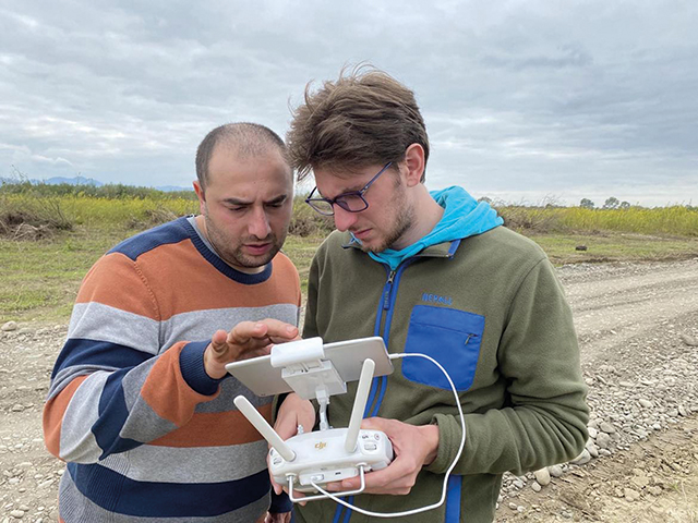
In order to develop a common methodology for monitoring the condition of natural habitats and the presence of invasive species, and to conduct monitoring that will guarantee the collection of compatible data and topical information about the location and size of damaged areas, the types of pressure and the evaluation of potential sources and forms of threat, a new project was launched in 2020, financed by the European Union, in four countries of the Black Sea Basin – Romania, Bulgaria, Armenia and Georgia: “Joint monitoring of environmental protection in the Black Sea basin countries — BSB Eco Monitoring”. The study areas in Georgia were selected by SABUKO, a non-governmental organization for the protection and conservation of wildlife in Georgia, taking into account the abundance of species and habitats presented, as well as the challenges faced by national parks. As part of the international project, Vasil Metreveli, along with Luka Kokiashvili, both researchers of the SABUKO research team, used remote sensing and a DJI Phantom 4 Multispectral drone to study the IPS in Kolkheti National Park.
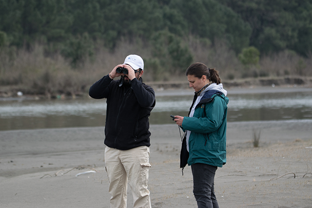
“The drone is equipped with six sensors: RGB, Red, Green, Blue, NIR, and RE and it allows us to sample the surface reflectance in six spectral bands of the electromagnetic spectrum,” Metreveli tells us. “Remote sensing itself is widely used to study different characteristics of the surface by measuring and analyzing the reflected and emitted radiation. The physical characteristics of the material determine what type of wavelength will reflect the most from its surface, therefore there are different reflectance values from the different surfaces in different bands of the electromagnetic spectrum.”
This variety of sensors allows the researchers to differentiate between the different materials and their characteristics, such as determining different types of soil, detecting healthy and unhealthy vegetation, measuring the temperature and moisture of the surface, and more.
The research in Kolkheti National Park started in 2021, aiming to detect invasive plant species, work on a plant invasion monitoring plan, and to differentiate between habitats of Kolkheti National Park.
In the first stage of the project, researchers framed the study design and selected sample plots where data needed to be obtained. 25 sample plots were chosen to sample each habitat type of Kolkheti National Park. The area of the sample plots varied from 3 to 6 ha. All drone flights were conducted in an automatic flight mode and all flight parameters were planned before each flight. The flight speed and altitude, side and frontal overlap between the aerial images and the camera angle were the same for all the flight missions, the only difference between flight missions being the area of sample plots (depending on the habitat diversity) and the times of the day. As the radiation during the daytime fluctuates, the data requires radiometric calibration, which in this case was done automatically by the sunlight sensor on the DJI P4 Multispectral which captures solar irradiance and maximizes accuracy and consistency of data collection at different times of the day.
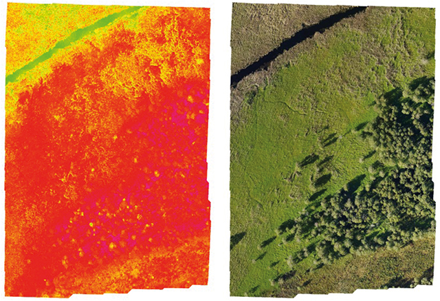
After the data were obtained, researchers made orthoimages and vegetation index maps of each sample plot using DJI Terra software. Vegetation index maps show the chlorophyll content, healthy and unhealthy vegetation, biomass, and the density of green leaves. The sensors of the DJI P4 Multispectral drone allowed the researchers to calculate all the vegetation indices and generate vegetation index maps (Image 1).
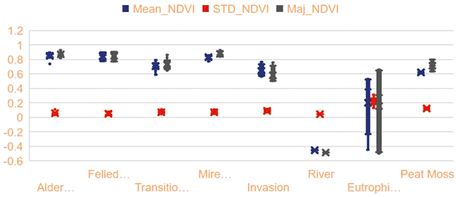
Using the vegetation index maps, the researchers detected invasive plant species and found significant differences between the habitats. Data analysis showed that NDVI (Normalized Difference Vegetation Index) values were significantly different between the habitat types, especially between the forest habitats and bogs and mires (Image 2). The areas covered by the invasive plant species were characterized by relatively low NDVI values than the local plant communities.
As the invasive plant species were detectable on the orthoimages, the researchers were able to calculate the area covered by those species on each sample plot (Image 3). The dynamics of invasion will be monitored over several years and the results will show the speed and the direction of the spread.
Including environmental variables in the analysis will also reveal the provoking factors and possible barriers to invasion. The monitoring results will ultimately prove highly beneficial so that the administration of the Kolkheti National Park can act effectively against the plant invasion and decrease the harm to the ecosystem of Kolkheti.
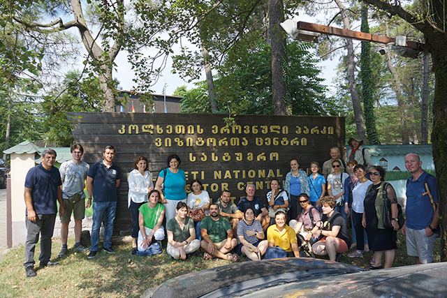
On August 8-10, a Cross-Border Meeting was held in Georgia, where representatives of the four countries met within the framework of the “Joint Monitoring for Environmental Protection in BSB Countries” project. Experts made reports, and on August 10 visited the Koljheti National Park.
The research project is ending at the end of August, and a monitoring plan will be given to the Kolkheti National Park administration. Further monitoring will take place in collaboration with them.
By Katie Ruth Davies


